Our spectral tomography allows for more accurate geological reconnaissance by filling in information between boreholes, reducing the need for drilling. Successfully delivering information where other non-invasive methods fail.
We provide services using our proprietary subsurface imaging technology. Our team possesses extensive expertise in both geophysics and geology, along with experience across various industries. This enables us to deliver not only geophysical images but also comprehensive reports with detailed information tailored to our clients’ needs.
We provide services using our proprietary subsurface imaging technology. Our team possesses extensive expertise in both geophysics and geology, along with experience across various industries. This enables us to deliver not only geophysical images but also comprehensive reports with detailed information tailored to our clients’ needs.
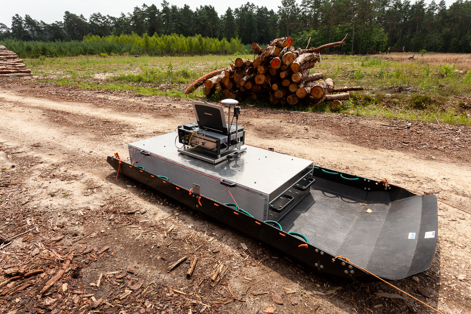
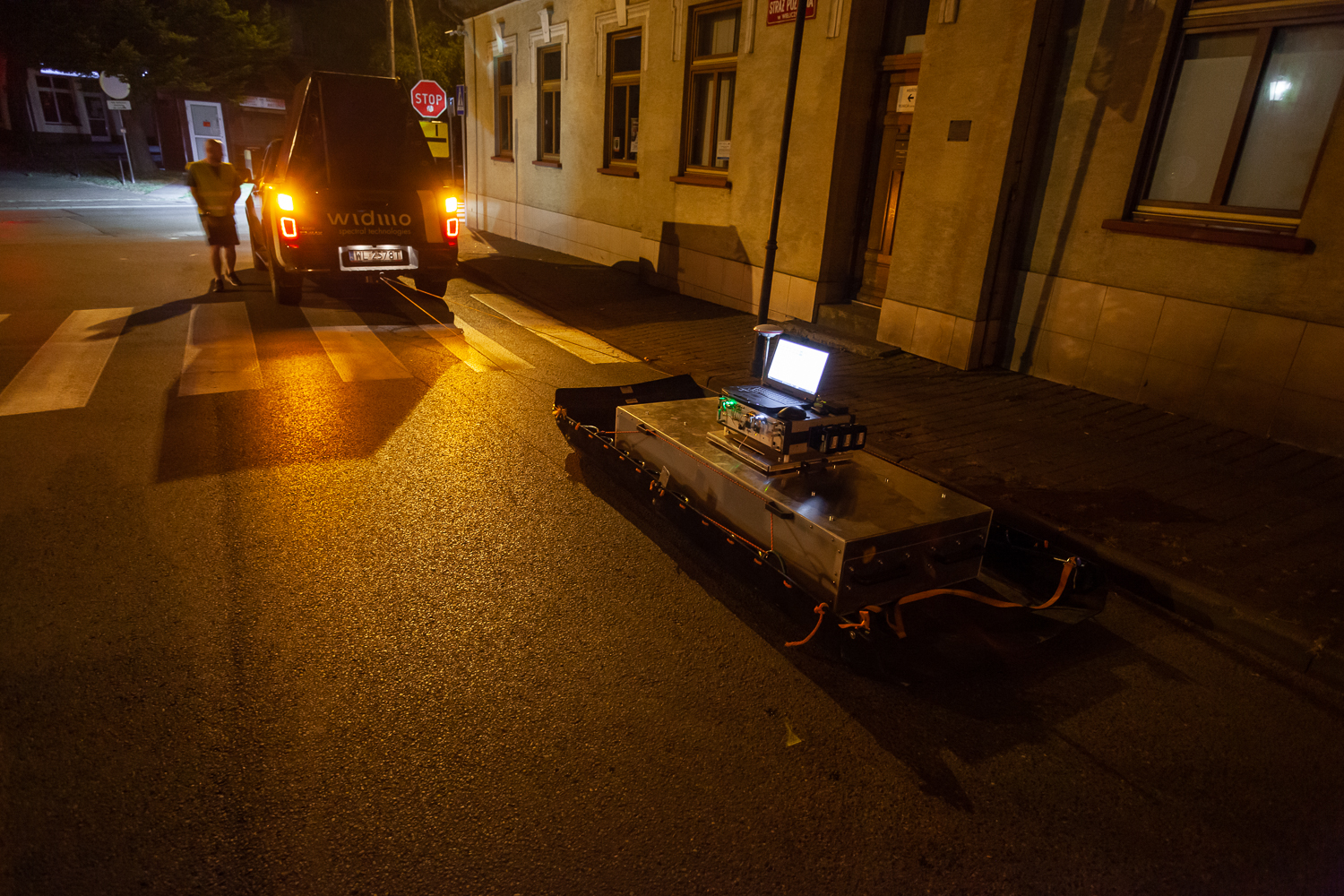
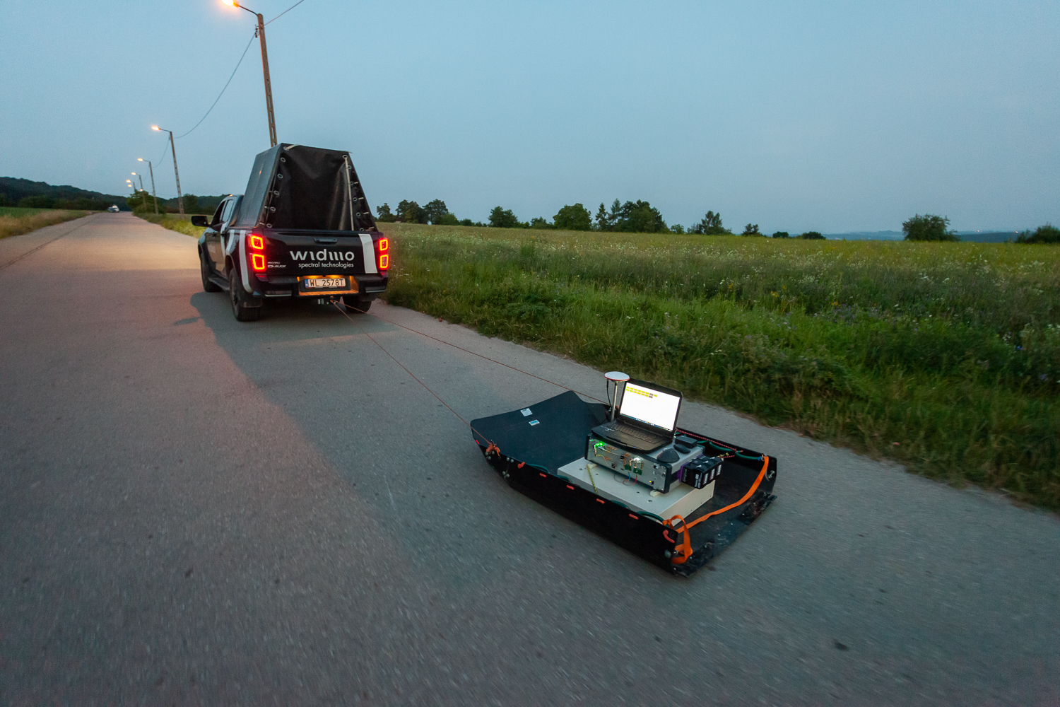
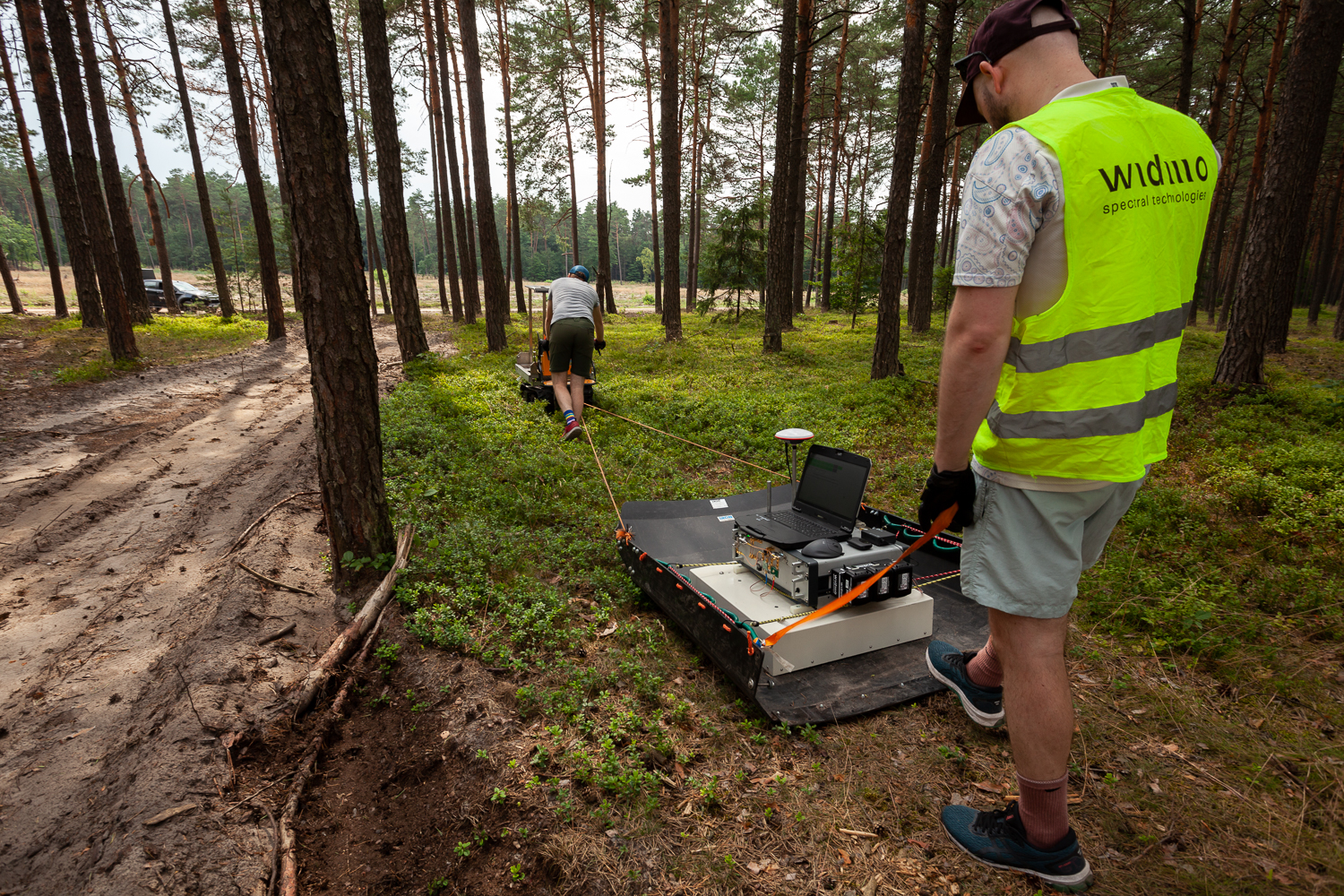
We use our own ground-penetrating radars, ensuring the highest quality data and full control over the entire surveying process.
The data is processed using our dedicated software, allowing us to fully leverage the potential of our technology.
Service options
1. BASIC: Measurements
- Document explaining the echograms in different frequency ranges,
- 6 tomography echograms for each route (profile) in a whole range of frequency and in 5 spectral decomposition ranges;
- 2 echograms in the power spectrum and in a derivative of the power spectrum;
- Routes maps
- Digital data in CSV and/or SEGY format information delivery
2. INTERMEDIATE: Measurements + Basic Analytics
- Document explaining the echograms in different frequency ranges;
- 6 tomography echograms for each route (profile) in a whole range of frequency and in 5 spectral decomposition ranges;
- 2 echograms in the power spectrum and in a derivative of the power spectrum;
- Routes maps;
- Analysis of the 8 types of echograms for each profile and marking of the spectral anomalies on the 2D echograms;
- Digital data in CSV and/or SEGY format information delivery
3. ADVANCED: Measurements + Advanced Analytics
- Document explaining the echograms in different frequency ranges,
- 6 tomography echograms for each route (profile) in a whole range of frequency and in 5 spectral decomposition ranges;
- 2 echograms in the power spectrum and in a derivative of the power spectrum;
- Routes maps
- Analysis of the 8 types of echograms for each profile and marking of the spectral anomalies on the 2D echograms;
- Interpretation linked to borehole data;
- Individual queries valued separately (e.g. estimation of overburden, layer pull, estimation of the volume of deposits, determination of the bottom of the deposit, differentiation of sand in clay or clay in sands);
- 3D anomalies distribution;
- Digital data in CSV and/or SEGY format information delivery
We understand that every client’s needs are unique and that sometimes specific problems may arise. We are happy to conduct a Proof of Concept project to determine the best solution for your specific situation. Let us know how we can help.
Testimonials
Our technology is recognized by the most prestigious institutions and companies, providing valuable information for the most challenging projects.

Geophysical Monitoring of Strategic Infrastructure.
Periodic monitoring of critical infrastructure, such as dams and power plant foundations, aimed to detect displacements over time, identify potential threats due to changes in the geological structure, and observe issues resulting from water activity.
“WIDMO demonstrated exceptional professionalism and dedication, providing state-of-the-art tools and solutions that were crucial to the success of our project. Their advanced geophysical imaging systems enabled us to precisely and efficiently monitor critical infrastructure, which is invaluable for ensuring the safety and long-term stability of the structures.”
Prof. dr hab. Mariusz Majdański
HEAD OF THE GEOPHYSICAL IMAGING DEPARTMENT
Team leadership
Our team of geophysicists and geologists brings extensive experience in managing and supervising projects in industries such as construction, mining, and the oil and gas sector. Additionally, we hold a wide range of geophysical and geological licenses essential for the effective execution of projects.

Dr Zygmunt Trześniowski
Head of Geophysical Services

Dagmara Krawiec
Geophysics Manager

Dr Paweł Pietrzykowski
Lead Geologist
Dr Zygmunt Trześniowski
Head of Geophysical Services
Dagmara Krawiec
Geophysics Manager
Dr Paweł Pietrzykowski
Lead Geologist
Dr Zygmunt Trześniowski
Head of Geophysical Services
Dagmara Krawiec
Geophysics Manager
Field team
Our field team has extensive experience working in the most challenging conditions, ensuring safe and efficient operations without disrupting processes on the survey site. Additionally, our team is fully competent in supplementing and acquiring all necessary information required for further data processing.